With a beautiful southern spring season upon us, it’s time to load up the backpack, leash the pup, and get outside for a hike! Singing “Sunshine on my Shoulders”, embrace the peace and clarity to be found in nature. As an Appalachian Trail thru-hiker last year, I, “Clarity”, hiked the length of the trail from Maine to Georgia in six months. Taking into account a reasonable driving distance from Athens, following are my recommendations for the top six day hikes not to be missed on the southern end of the Appalachian Trail.
Appalachian Approach Trail – Amicalola Falls State Park
- Special features: This is Georgia’s busiest state park for a reason. Amicalola Falls is the tallest waterfall east of the Mississippi River. The Visitor’s Center and the Lodge are on site. The Lodge offers breakfast, lunch, dinner, and drinks and a breathtaking view of the mountain sunset from the balcony!


- Difficulty level: This trail is strenuous but short and it is easy to stop before the top if need be. You climb 604 stairs and gain almost 900 feet of elevation in only one mile, but consider it a solid Gluteus workout with views unlike any other. How often do you literally have the opportunity to climb alongside a waterfall? The trip up and down is about two miles in total.


- GPS Coordinates and drive time: Amicalola Falls State Park is located at coordinates N34 33.467 W84 15.000. The drive from Athens takes just under two hours.

Snowy surprise at Amicalola Falls 
View from the top of the falls
Springer Mountain, Georgia
- Special features: Springer Mountain marks the southern terminus of the Appalachian Trail. Though thousands attempt to hike the trail in its entirety each year, only a few hundred make it all the way to Mount Katahdin in Maine, the Appalachian Trail’s northern terminus. The view at Springer’s summit is very pretty and a noteworthy plaque rests in the rock face at the top. Plan a picnic here! Comfortably spacious with a view of the Blue Ridge Mountain Range.
 Clarity contemplating this final step on the A.T.
 Finishing the trail with trail pals!
 - Difficulty level: This hike is moderate in difficulty but is only a 0.9 mile walk from the Big Stamp Gap parking area. For a longer hike, park at Amicalola State park and walk 8.5 miles each way to arrive on top of Springer Mountain. Start early as you have to walk back down.
 Welcome!
 - GPS Coordinates and drive time: Parking at Big Stamp Gap is located at coordinates N34 38.257 W84 11.725. The drive is 2 hours and 20 minutes from Athens.


View from Springer’s summit
Blood Mountain, Georgia
- Special features: Blood Mountain is the highest peak on the 75 miles of the Appalachian Trail that runs through Georgia and the sixth highest peak in our state. It offers breathtaking views for a picnic lunch, and on a smogless day, you may be able to see downtown Atlanta in the distance!

- Difficulty level: This is a strenuous, 1.3 mile hike up to the summit with an elevation gain of 1,800 feet. It’s worth the effort to see what you see.

- GPS Coordinates and drive time: Park at the Byron Reece Nature Trail 0.2 from Neel Gap on US Hwy 19 located at coordinates N34 44.464 W83 55.237. The drive from Athens will take 1.5 hours.


Albert Mountain, North Carolina
- Special features: A fire tower rests on the summit of Albert Mountain and provides spectacular panoramic views! This spot is also a significant landmark for an Appalachian Trail thru-hiker. For one who begins in Georgia on a northbound journey, this marks the first hundred miles. For hikers who walk south from Maine, this marks the last hundred miles.
 100 miles left for Clarity!
 View from Albert Mountain
 - Difficulty level: This is an easy hike from option number one and a moderate hike if you choose option number two. The first option is to park 0.2 miles away from the summit on US Forest Service Road 67. Or option number two is to hike 5.8 miles south from Rock Gap. Plan enough daylight to walk the same distance back!
 View from Albert
 Trail to Albert Mountain
 - GPS coordinates and drive time: Coordinates for option number two are N35 5.640 W83 31.3555. The drive from Athens will take just over two hours.
Clingman’s Dome, Tennessee
- Special features: Nestled in the Great Smoky Mountains National Park, with its peak scraping the sky at over 6,600 feet in elevation, Clingman’s Dome marks the highest point on the entire 2,189 mile Appalachian Trail. Sadly, no dogs are allowed in the Smokies, so leave your pup at home for this hike. There is a concrete observation tower allowing a leisurely stroll up to an extraordinary 360 degree view of the countryside below. Even in the middle of the summer, a jacket is recommended if you plan to view the highest point.

- Difficulty level: This hike is labeled as easy. It follows a paved half-mile path between the tower and the parking area. A more challenging day hike option reaching the strenuous level would be to park at Newfound Gap and hike seven miles south and back for a rigorous but doable day hike. Start early and carry a headlamp, just in case.

- GPS Coordinates and drive time: For the easy option, GPS coordinates are N35 33.433 W83 29.634. For the challenging option, GPS coordinates are N35 36.669 W83 25.540. The drive from Athens will take around 3 hours. Plan to spend a night or two in nearby Gatlinburg for an added bonus!

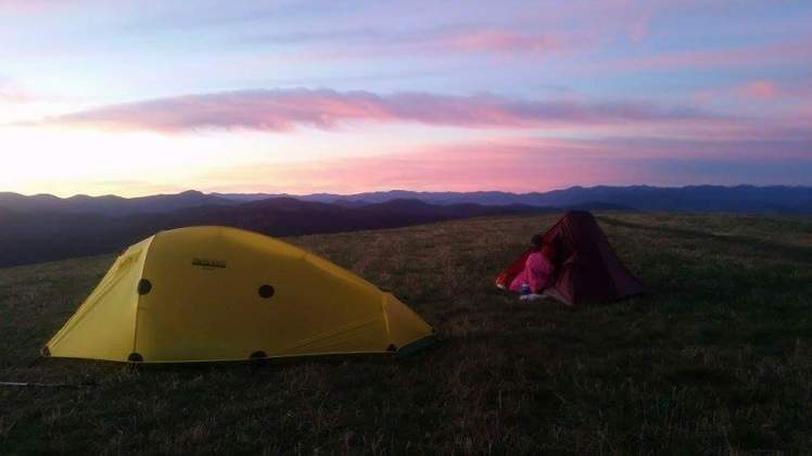
Max Patch, North Carolina
- Special features: If you look up the word “wow” in the dictionary, there’s probably a picture of Max Patch as a visual! This gets Clarity’s “best sunrise and sunset” spot on the entire Appalachian Trail and makes the top day hike list and the top place to overnight. Max Patch is a fun name for a grassy bald with 360 degree views and ample camping space. No fires please.

- Difficulty level: Easy 0.5 mile walk to reach the bald’s 4,629 foot summit.


- GPS Coordinates and distance: N35 47.776 W82 57.762. It is well worth the 3.5 hour drive from Athens.
There you have them! These are the most unique, memorable day hikes to experience on the southern end of the Appalachian Trail. Please share liberally if you found this article interesting. Visit the A.T. for Newbies section at www.AppalachianTrailClarity.com to learn more about exploring the A.T or to email Clarity. You get one shot at life and you hold the map. Explore, breathe, learn, live.

Thank You! “It’s not the load that breaks you down … it’s how you carry it.”
LikeLike
Great trails and great article, but Albert Mountain and Max Patch are both in North Carolina.
LikeLike
Oh wow, not sure how I made those mistakes. Max Patch is right on the border of TN and NC. Anyway, thanks! Changes noted.
LikeLike
There is no day hike parking at Mountain Crossing (Neel Gap). If you wish to climb to top of Blood Mountain walking South you need to park down the street at Bryon Reece Nature Trail.
http://www.atlantatrails.com/hiking-trails/neels-gap-byron-reece-trail/
LikeLike
Gratefully noted. Thanks!
LikeLike
Hi thanks ffor sharing this
LikeLike